| Name | Location | Grade | List Entry |
|---|---|---|---|
| Christ Church | Manchester Rd, Denton | II | 1067969 |
| Church of St Mary | Haughton Green | II | 1067968 |
| Lychgate at Church of St Mary | Haughton Green | II | 1356486 |
| Church of St Anne¹ | St Anne’s Rd, Haughton | I | 1309251 |
| St Anne’s Church Rectory | St Anne’s Rd, Haughton | II* | 1067970 |
| Lychgate and churchyard wall to Church of St Anne and Rectory | St Anne’s Rd, Haughton | II | 1356487 |
| Church of St Lawrence | Stockport Rd, Denton | II* | 1067971 |
| Lychgate at Church of St Lawrence and churchyard wall to west and south | Market St & Town Ln, Denton | II | 1309198 |
| Horse mounting block near Lychgate of Church of St Lawrence | Town Ln, Denton | II | 1356488 |
| St Mary's Church of Our Lady of Sorrows | Duke St/Market St, Denton | II | 1448761 |
| Hyde Hall² | Town Ln, Denton | II* | 1318129 |
| Quadrangle of farm building at Hyde Hall | Town Ln, Denton | II | 1067972 |
| Former hat works at 53 and 55 Stockport Rd | Denton | II | 1163339 |
| Band Stand | Victoria Park, Denton | II | 1163716 |
| War Memorial | Victoria Park, Denton | II | 1430008 |
| Haughton Dale House | Meadow Ln, Haughton Green | II | 1309247 |
| Manor Farmhouse | Haughton Green Rd, Haughton Green | II | 1356485 |
| Former domestic hatting workshop (Bow Garret) | Market St, Denton | II | 1419033 |
| Section of a boundary ditch known as Nico Ditch³ | Denton Golf Course, 320m south west of Lodge Farm | 1016197 | |
| Tame Viaduct4 | Reddish Vale | II | 1389626 |
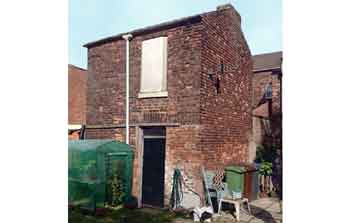 Bow Garret
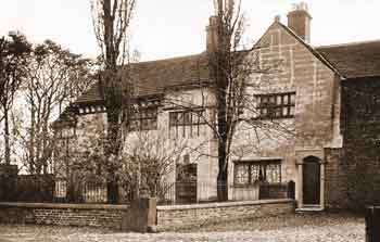 Hyde Hall
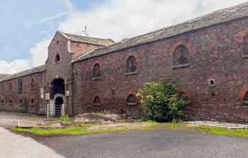 Farm Buildings at Hyde Hall
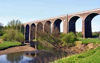 Tame Viaduct, Reddish Vale
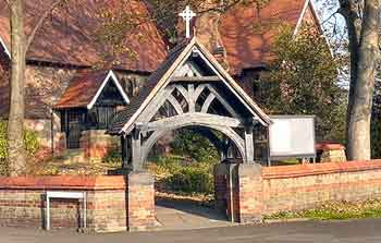 Lychgate at St Anne's Church, Haughton
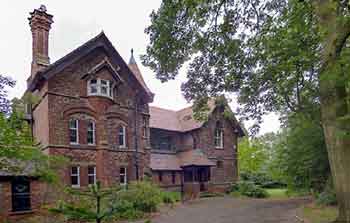 St Anne's Church Rectory, Haughton
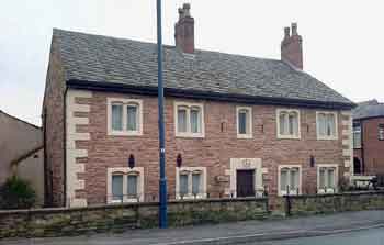 Manor Farmhouse, Haughton Green
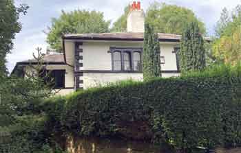 Haughton Dale House
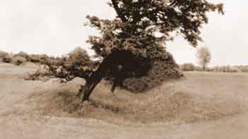
Nico Ditch
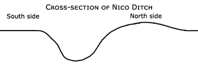
Nico Ditch is the only Scheduled Ancient Monument in Denton and it is a linear boundary of the Anglo-Saxon period. It is ‘U’ shaped in section and about 1.64 to 2.19 yards deep by 4.38 yards wide with a bank on the north side
about 0.55 yards high by 5.45 yards wide at the base. The ‘U’ section, rather than ‘V’ section of the ditch suggests that it was used as a boundary rather than for defensive purposes.
The ditch was about 7.84 miles long, as the crow flies, between Ashton Moss in Ashton-under-Lyne (Grid Ref: SJ 92141 98816) to Ryebank Fields in Chorlton-cum-Hardy (Grid Ref: SJ 81027 94651) and it may have extended through Stretford for a short distance. It passed through Audenshaw (now below Audenshaw Reservoirs), Denton, Gorton, Levenshulme, Rusholme and Fallowfield (Platt Fields Park).
It was constructed sometime between the end of the Roman Era (Roman Legions were withdrawn in 410AD) and the Norman Conquest of 1066. Its original purpose is unknown but the most likely reason for its construction during the Anglo-Saxon period is that it was an administrative boundary; either a 7th century boundary of Anglo-Saxon expansion or a late 8th to early 9th century boundary between the kingdoms of Mercia and Northumbria. One possibility is that it was constructed in the reign of Offa, King of Mercia from 757 until 796AD. In this period the Anglo-Saxon kingdoms of Mercia and Northumbria struggled for control of North West England aggravated by Danish inroads. Eventually the area became part of Danelaw and the river Mersey was the boundary between Mercia and Danelaw.
In addition to the section on Denton Golf Course another scheduled section of Nico Ditch is situated in Platt Fields, Fallowfield, Manchester, 525 yards SSE of Platt Hall (Grid Ref. SJ 85527 94439). This is List Entry No. 1015132.
At the western end of this 148 yards long section of Nico Ditch in Platt Fields (near the boating lake) there is a stone plaque inscribed:
Nature Reserves & Woods in and around Denton & Haughton
These are situated alongside the river Tame and they include:
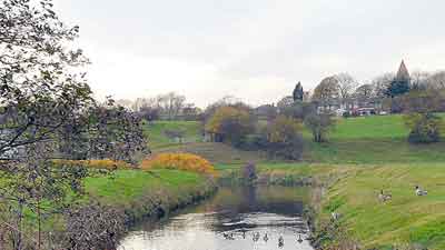
River Tame, Haughton Dale.
Further Reading
Crofton, H T, 1906. Transactions of the Lancashire and Cheshire Antiquarian Society, Agrimensorial Remains Round Manchester, pp. 112-171, Vol. XXIII. Manchester: Richard Gill.
Nevell, Mike (1992). Tameside Before 1066. Tameside Metropolitan Borough Council.
Nevell, Mike (1998). Lands and Lordships in Tameside. Tameside Metropolitan Borough Council with the University of Manchester Archaeological Unit.