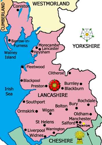
Location of Denton & Haughton in the County Palatine of Lancashire
Denton and the neighbouring township of Haughton are situated in the south east of the historic County Palatine of Lancashire, six miles from Manchester.
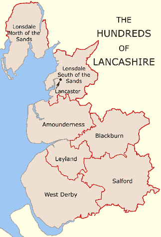
Here the river Tame forms the boundary with the County of Cheshire. They were described as being in the Parish of Manchester, Hundred of Salford.
The purpose of the Hundreds was to facilitate the collection of taxes and the enforcement of law and order, which were administered through Leet-Courts.
These courts were held in a Manor before the Lord of the Manor (or his Steward), who had the right to hold such Court.
In Lancashire, these courts were also known as Wapentake Courts and they were subordinate to the County Court, which sat at Lancaster.
On the 25 Aug 1856 it was decided that Denton should adopt the Public Health Act and consequently, in 1857, a Local Board of Health was appointed.
However it was not until the 20 Jun 1877 that the neighbouring township of Haughton appointed a Local Board of Health.
On the 29 Sep 1884 the independent governances of Denton and Haughton came to an end when the two townships amalgamated under one authority known as the Denton and Haughton Local Board.
This arrangement lasted until the 25 Jun 1894 when the two townships were united with the name of Haughton being removed, amid much acrimony.
The local governing body henceforth became known as Denton Urban District Council.
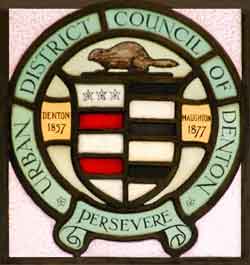
Window showing the unofficial arms of Denton
These arms were introduced when the independent Local Boards of Denton and Haughton merged to form the joint Denton and Haughton Local Board.
The dates 1857 and 1877 flanking the arms are the dates when Denton and Haughton adopted the Public Health Act of 1848 by establishing independent Local Boards.
This window is one of two above the entrance door to the library/town hall.
The arms represent the union of Denton and Haughton, consisting of a combination of the arms of two families with those names;
i.e. Denton and Haughton (Houghton). The beaver is the emblem of the hat industry in the townships.
The official Civic Arms of Denton Urban District Council were granted on the 23 Mar 1936.
The earliest record of Haughton is in the Final Concords For Lancashire, Part 1, 1189-1307. The township of Haughton includes Haughton Green, Haughton Dale and Lower Haughton.
Lancashire Day, 27th day of November
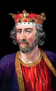
On the 27th day of November 1295 representatives from Lancashire were given a ‘Writ of Summons’ by King Edward I to attend a gathering at Westminster that was to be England’s first legally elected legislature.
Later, this gathering (or Commons) became known as the ‘Model Parliament’ because it marked the beginning of democracy in England.
Altogether 292 members of the Commons were elected from all over England and they were comprised of:
Two knights from each shire
Two burgesses from each borough
Two citizens from each city
Seven earls
42 barons
One proctor from each cathedral
Two clergy from each diocese
King Edward I presided over the Commons.
The Duchy of Lancaster is a historic body comprised of the following: Lancashire (including Greater Manchester and Merseyside) and some areas in Cheshire, the former West Riding of Yorkshire,
Staffordshire and parts of southern England and Wales. Today the estates cover more than 44,480 acres of rural land in England and Wales, around 88,960 acres of foreshore properties, as well as thirteen historic properties,
including Lancaster Castle (Lancashire), Bolingbroke Castle (Spilsbury, Lincolnshire), Knaresborough Castle (Yorkshire), Pontefract Castle (Yorkshire), Pickering Castle, North Yorkshire, Halton Castle (Runcorn, Cheshire),
Peveril Castle (Castleton, Derbyshire), Wirksworth Castle (Derbyshire) and Ogmore Castle (near Bridgend, South Wales).
King Edward I.
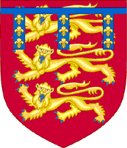
Crest of the Duchy of Lancaster.
On the 30 Jun 1267 Henry III created his son, Edmund Crouchback (1245-1296), as the 1st Earl of Lancaster and Leicester.
Thomas (c.1278-1322), 2nd Earl of Lancaster and Leicester.
Henry (1281-1345), 3nd Earl of Lancaster and Leicester.
Henry of Grosmont (c.1310-1361), 1st Duke of Lancaster and 4th Earl of Leicester.
In 1351 Henry of Grosmont, was made the 1st Duke of Lancaster and he was also granted palatinate powers, that is, royal powers (or powers belonging to the palace).
These powers lapsed with Henry Grosmont’s death on the 23 Mar 1361 but on the 13 Nov 1362 they were restored to the most famous Duke of Lancaster, John of Gaunt (1340-1399), son of Edward III and
they were made hereditary. John of Gaunt, 2nd Duke of Lancaster, was succeeded by his son, Henry Bolingbroke, who became Henry IV on the 30 Sep 1399.
Ever since 1399 the title of Duke of Lancaster has been held by the reigning Sovereign.