The Hollinwood Branch left the mainline of the Ashton Canal at Fairfield Junction, Droylsden, just above lock 18, and it proceeded in a northerly direction for about 2½ miles to Waterhouses.
Here it climbed through four locks and the Fairbottom Branch commenced at the top of these. The Hollinwood Branch continued for about another 1¾ miles, climbing through another four locks in the process,
to terminate at Hardman Fold Basin adjoining Drury Lane, Hollinwood. From this basin there was a private branch canal to Hollinwood Top Wharf, known as the Werneth Branch, which was about 800 yards long.
The Werneth Colliery Company built this private branch and its purpose was to connect Old Lane Colliery at Werneth to the Ashton Canal via the Hollinwood Branch.
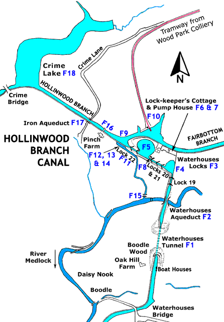
The Hollinwood Branch is now derelict but in the vicinity of Waterhouses and Daisy Nook it is still the custodian of the remains of a unique group of canal features that were situated between Waterhouses Bridge and
Crime Bridge (both now demolished). The distance between these two bridges is only ¾ mile and the best way of illustrating these features is to portray a journey between them. Today, much of the area around Waterhouses
lies within the Daisy Nook Country Park in the care of the National Trust.
Hollinwood Branch Canal, Features 1 to 18
Commencing at Waterhouses Bridge and travelling in the direction of Crime Bridge, the towpath is on the left-hand side of the canal. Boodle Wood is soon reached and this is where Waterhouses Tunnel was located.
Just beyond Waterhouses Tunnel, the river Medlock is arrived at and the canal crosses the river on Waterhouses Aqueduct.
Ahead of the river Medlock the ground rises and here the canal climbs through the four Waterhouses Locks.
As previously mentioned, beyond the bottom lock the canal turns abruptly to the north west and on the outside of the bend the lower side pond is located.
Immediately above the staircase locks, on the offside of the canal, is the upper side pond.
Between the two side ponds, the land slopes steeply upwards and the Fairbottom Branch runs across the top. At the top of the slope, by the side of the Fairbottom Branch, the next two features were located.
Beside the head of lock 21, on the offside, there once stood a brick-built hut with a slate roof.
Above Waterhouses top lock, the Fairbottom Branch leaves the Hollinwood Branch on the offside.
Adjoining the junction, on the offside of the Fairbottom Branch, was the Wood Park Colliery Loading Stage.
The colliery was operated by the Chamber Colliery Company and Wood Park Colliery Tramway connected it to the staithe to
enable boats to be loaded with coal.
The next three features were just above the top lock on the towpath side.
Before the spillway started to descend the valley side proper there was a footbridge across it and below this there was a waterfall, marked on maps as a weir.
Proceeding a short distance along the canal a footbridge is reached.
Continuing along the canal, a second noteworthy aqueduct is soon reached.
Ahead of the aqueduct there is a lake on the offside of the canal.
Crime Bridge lay just beyond Crime Lake and this brings to an end the short journey along the Hollinwood Branch Canal through Waterhouses and Daisy Nook.
Gallery
Click thumbnails for full pictures, then click browser back button/arrow to return here
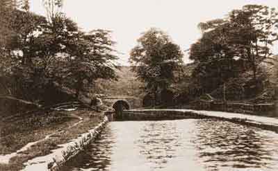
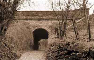
1: The north portal of Waterhouses Tunnel viewed from Waterhouses Aqueduct, early 20th century.
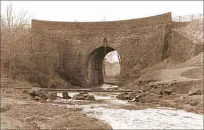
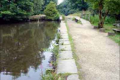
2: Waterhouses Aqueduct viewed from the river Medlock, 31 Mar 1983.
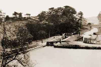
3: Waterhouses bottom lock (lock 19) looking towards Waterhouses Tunnel, early 20th century.
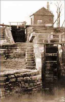
3: Waterhouses staircase locks (locks 20 and 21) with Feature 8, the hut, on the right.
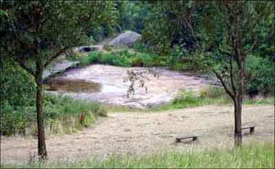
4: Lower Side Pond with Waterhouses bottom lock (lock 19) in the background, 20 Jul 2006.
The pond is nearly empty due to a long period without rain.
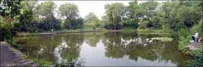
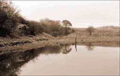
5: Upper Side Pond (Sammy's Basin), 20 Jul 2006.
The Fairbottom Branch runs across the back of the pond.
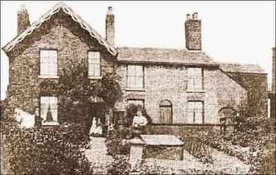
6: Cottages at Waterhouses, c.1890.
They were occupied by the staff who cared for the locks and pump house. They were also used for the collection of tolls.
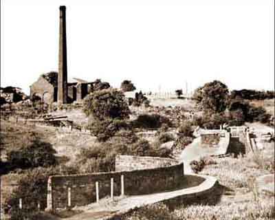
7: The Waterhouses Pump House, c.1960.
Waterhouses Aqueduct is in the foreground and locks 19 and 20 are beyond on the right and left respectively.
10: Site of the Chamber Colliery Company's Loading Stage (Wood Park Colliery) on the offside of the Fairbottom Branch, 31 Mar 1983.
Viewed looking across Feature 9, Waterhouses Junction.
12: Spillway, 20 Jul 2006.
Viewed looking towards the top lock (lock 22). The original Spillway Towpath Bridge (Feature 13) is no longer extant but three plinth stones for it can be seen on the right.
Horses accessing the Fairbottom Branch used the wooden footbridge (Feature 11) across the tail of lock 22 to cross the Hollinwood Branch.
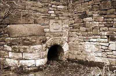
14: Culvert outfall below the canal near top lock, 31 Mar 1983.
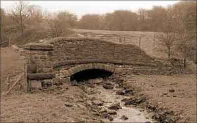
15: Accommodation bridge over a stream near the river Medlock, 31 Mar 1983.
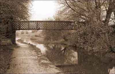
16: Pinch Farm Footbridge looking towards Iron Aqueduct over Crime Lane, which is just beyond the bridge, 31 Mar 1983.
In 2011 it was badly damaged by vandals and it was demolished by Oldham Borough Council in April 2016.
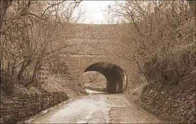
17: Iron Aqueduct over Crime Lane, 31 Mar 1983.
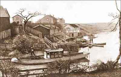
18: Crime Lake with the steamer 'Pioneer' in the foreground, early 20th century.
19: Valley Aqueduct on the Fairbottom Branch, 31 Mar 1983.

 Hollinwood Branch Canal, Features 1 to 18